WHAT IS A COASTAL DUNE?
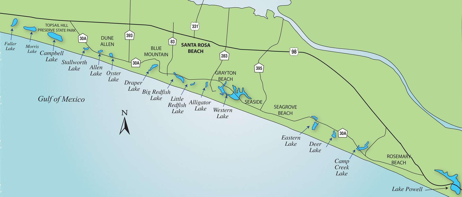
Coastal dune lakes are bodies of water found in dune ecosystems within two miles of the coast.
They’re typically shallow and irregularly shaped. Coastal dune lakes are usually permanent water bodies, but their water levels fluctuate substantially since they create transitory interchanges with the Gulf of Mexico. The lake-water is composed of both fresh and saltwater that comes from tributaries, groundwater seepage (from uplandsand from the Gulf), rainfall, exchange with the Gulf, and coastal storm surges. The lake-water is generally colored (e.g., tea or black colored) due to the dissolved organic matter it contains. This is a natural phenomenon, and it’s nothing to be worried about! While these lakes are exposed to normal weather conditions just like any lake, Florida’s coastal dune lakes are also tremendously impacted by hurricane activity (i.e., storm frequency, strength, and duration).
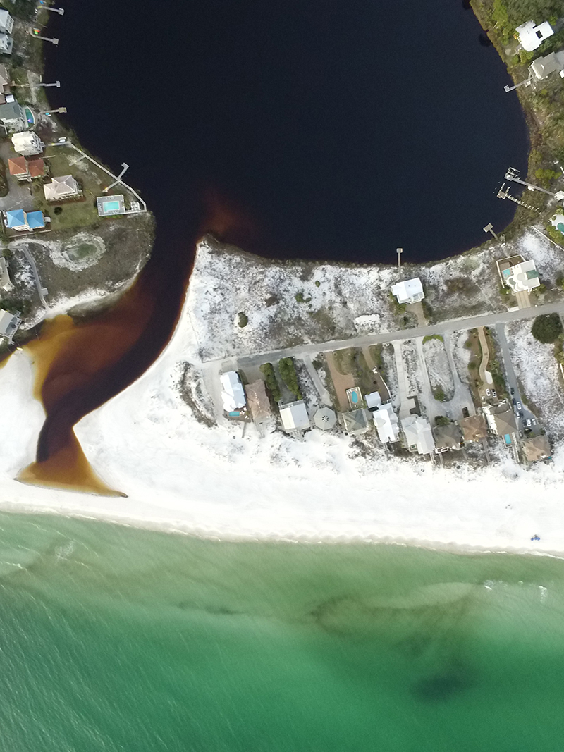
One of the most interesting features of Walton County’s coastal dune lakes is their intermittent connection to the Gulf of Mexico. When a coastal dune lake reaches a relatively high water level, it actually breaks through the dune system and the beach sand and empties into the Gulf of Mexico. The channel that is formed between the lake and the Gulf is known as the lake’s outlet or outfall. Depending on tides and weather conditions (particularly wind), saltwater from the Gulf may enter the lake, along with saltwater plants and animals. The drainage of the lake and potential exchange with the Gulf continues until equilibrium is reached and the opening closes.
Each of Walton County’s coastal dune lakes has its own personality, based on the combination of its size, watershed features, surrounding land uses, and outlet characteristics. Outlet openings vary greatly in length, frequency and duration. They are driven by each lake’s critical high water level as well as prevailing climatic conditions (e.g., droughts and rain). As a result, some of the dune lakes can be completely freshwater, some brackish, and some salty, with varying degrees of salinity occurring between different lake stages. The changing condition of water chemistry in the coastal dune lakes makes them dynamic, biologically diverse ecosystems.


WHERE CAN I ACCESS THE LAKES, AND HOW CAN I USE THEM?
Click here to view a guide to Public Access Points on the Coastal Dune Lakes.
Visit Walton Outdoors for a great synopsis of recreational activities and access points on the coastal dune lakes:
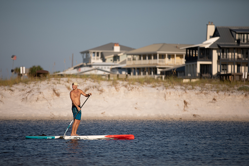
Fish, hike, paddle and enjoy birding on the coastal dune lakes of South Walton
CBA and the Coastal Dune Lakes
Walton County’s coastal dune lakes are a visual trademark of the southern end of the county and a source of great pride among citizens. They are unique ecosystems marked by their dark, brackish water and intermittent opening to the Gulf of Mexico.
The Choctawhatchee Basin Alliance has partnered with Walton County and other concerned citizens and organizations for over a decade to monitor, investigate, restore, and educate people about the coastal dune lake systems.
Management Plan
Notably, CBA orchestrated the development and publication of A Management Plan for Walton County’s Coastal Dune Lakes (October 2008). This document is the product of a two-year process involving several rounds of citizen and stakeholder input; it was promptly adopted by the Board of County Commissioners. We are proud that this document represents a truly collaborative effort and contains the best science on the coastal dune lakes. It is a comprehensive living document that can guide and advance the conversation among citizens and decision-makers when it comes to land management surrounding the coastal dune lakes.
Monitoring
CBA manages a volunteer water sampling program in cooperation with Florida LAKEWATCH, whereby citizen-scientists collect monthly nutrient, chlorophyll, water clarity, and water chemistry data on the lakes. We have a decade’s worth of monthly data on most lakes. Explore our website to learn more about CBA’s Water Quality Monitoring Program. Data is available to the public upon request. We are trying to make it available on our website very soon!
Research
CBA has commissioned scientific studies on the coastal dune lakes and provided field assistance for these projects. With CBA’s assistance, the University of Florida’s Florida LAKEWATCH program has created bathymetric maps and completed plant surveys on several of the coastal dune lakes. In addition, Dr. James Jawitz, UF Soil and Water Science Department, completed an initial hydrologic study and continues to collect data on Campbell, Draper, and Camp Creek lakes. Reports of these research activities can be found on our Coastal Dune Lakes Research & Publications page.
Restoration
CBA’s primary restoration activity on the coastal dune lakes is the identification and control of exotic and invasive plant species followed by revegetation with native species. This work is conducted through a grant from the Coastal Program of the United States Fish and Wildlife Service (USFWS).
On Oyster Lake, CBA has been part of a large-scale restoration project that allowed for two roads to be removed from the lake and replaced with bridges. CBA conducted water quality monitoring and coordinated a sediment study, exotic plant control, and re-vegetation with native plants prior to this work. We coordinated the design & installation of educational signage on-site. CBA will be responsible for post-project water quality and sediment analysis following the final phase of the project. Funding for this project came from Three Rivers R&CD, a Five-Star Restoration Grant, and the USFWS.
Education
CBA works in both formal and informal settings to educate citizens about the coastal dune lakes of Walton County. As part of our restoration work, students from South Walton High School (SWHS), Collegiate High School of Northwest Florida State College, and the 4H program, as well as teachers from Bay and Butler elementary schools have helped us map exotic and invasive plant species on the lakes. SWHS students planted several hundred plants to restore the shoreline of Oyster Lake. AmeriCorps members and students from the University of West Florida work with us each year to maintain our water quality monitoring program on the lakes.
In addition to this work with local schools, CBA educates citizens through participation in local festivals and public workshops. We also work with the county extension service (UF/IFAS) in creating educational materials and distributing information.
See more programs improving the coastal dune lakes below:
Water Quality Monitoring
Invasive Species Removal
Living Shorelines
Research

